Client-Side Geoscience & WebGIS Studio

Interactive Earth,
Delivered in Real-Time.

A high-performance digital laboratory bridging advanced earth sciences (tectonics, InSAR geodesy, terrain morphometry, and subsurface geology) with zero-install web technologies.

14 WebGIS Engines
4 Binary Converters
GEE Cloud Script Vault
100% Local Browser RAM
Unified Spatial Architecture

One Platform, Five Core Pillars.

Everything you need to process satellite rasters, analyze terrain, write cloud scripts, and visualize 3D geology.

14 Interactive Modules

WebGIS Analytics Hub

From real-time USGS earthquake monitoring and Sentinel-1 InSAR deformation to 8-band DEM morphometry, D8 hydrology, and 300 DPI map layout composition.

Explore All 14 Dashboards
Cloud Scripts

GEE Code Vault

Ready-to-copy Google Earth Engine scripts for SAR time-series prep, cloud masking, and lineament hillshades.

Browse Scripts
WASM & Workers

Geospatial Converter

Convert Sentinel-2 JP2 to GeoTIFF, TIFF to Google Earth KMZ, and Shapefile/CSV to GeoJSON locally.

Open Converters
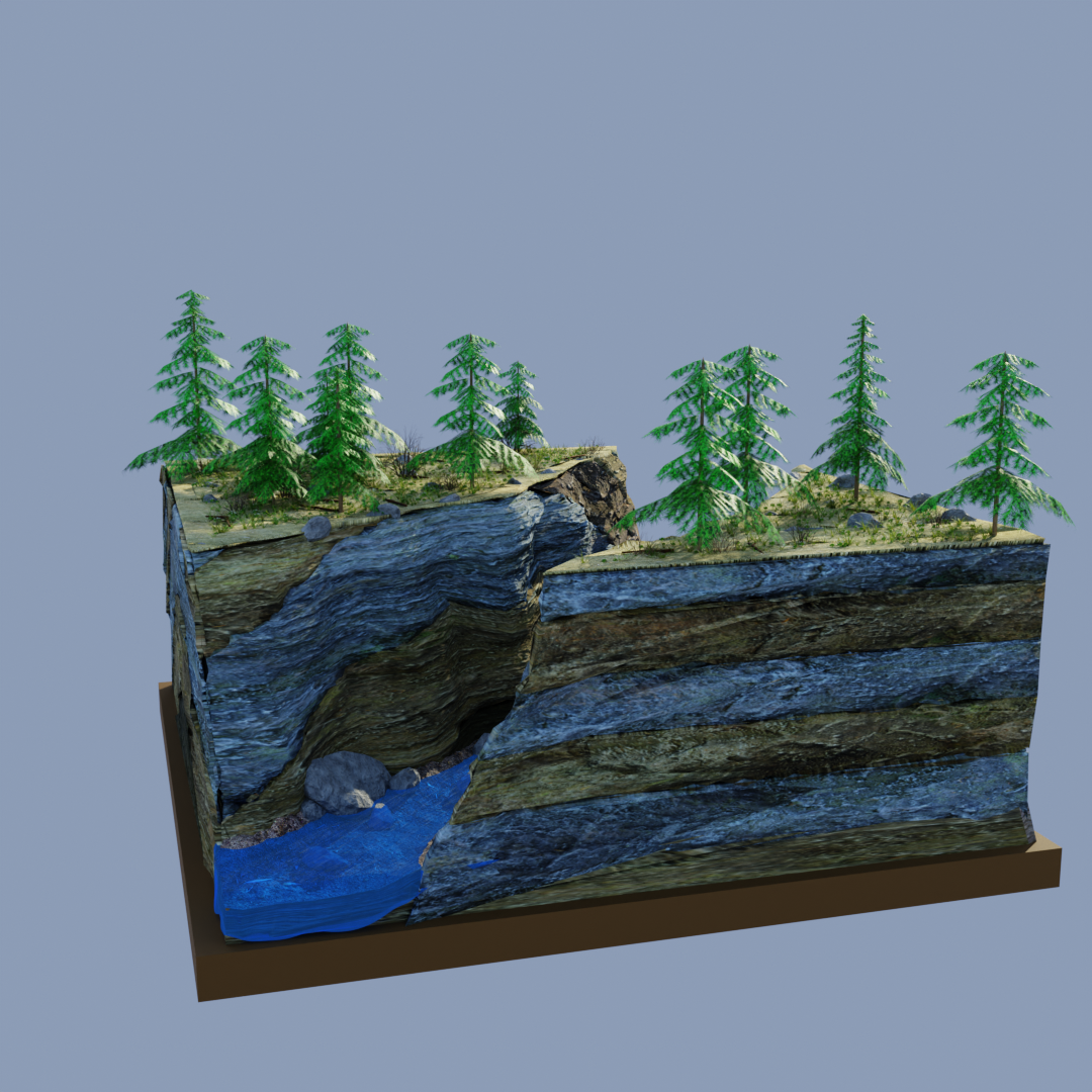
Blender & WebGL

3D Geological Gallery

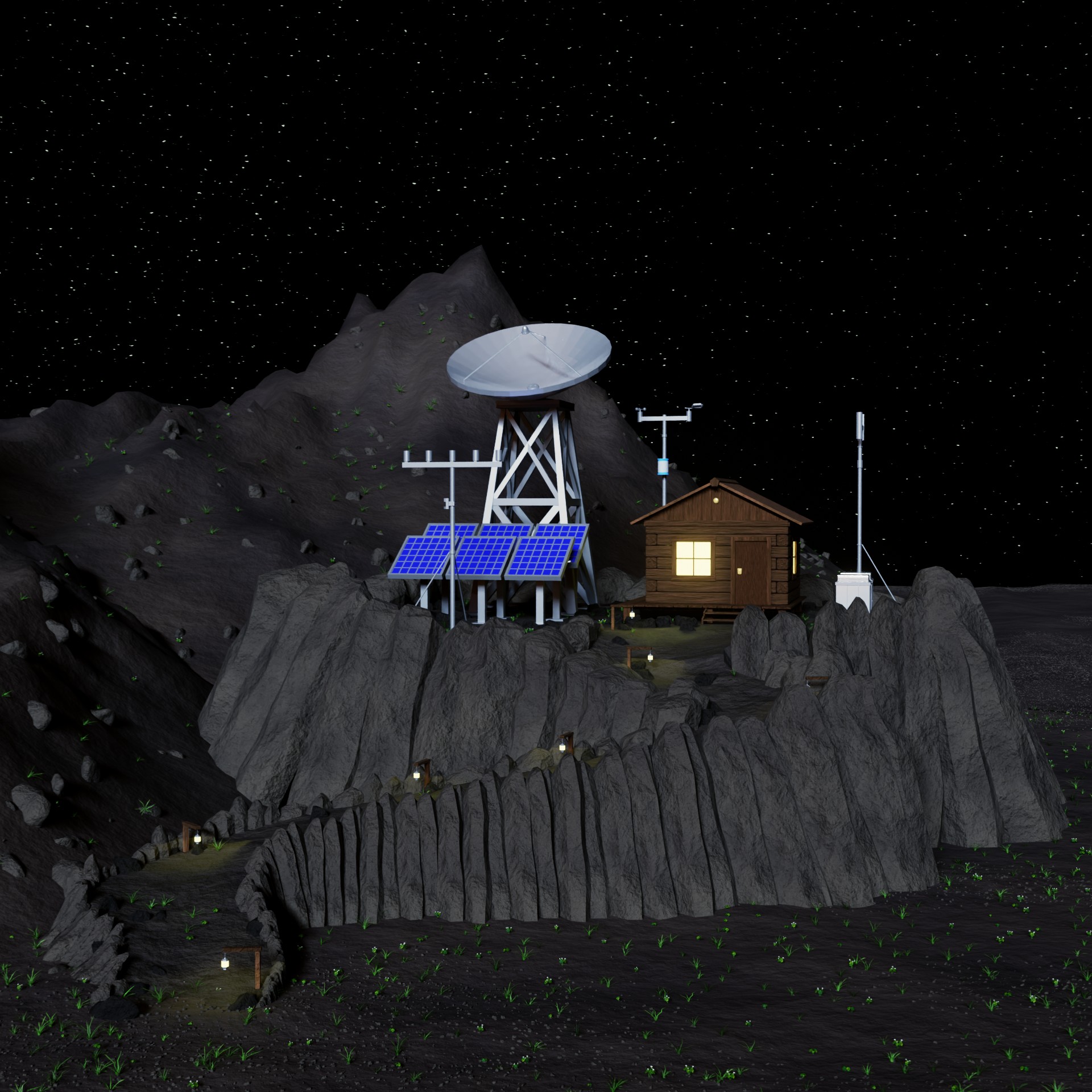
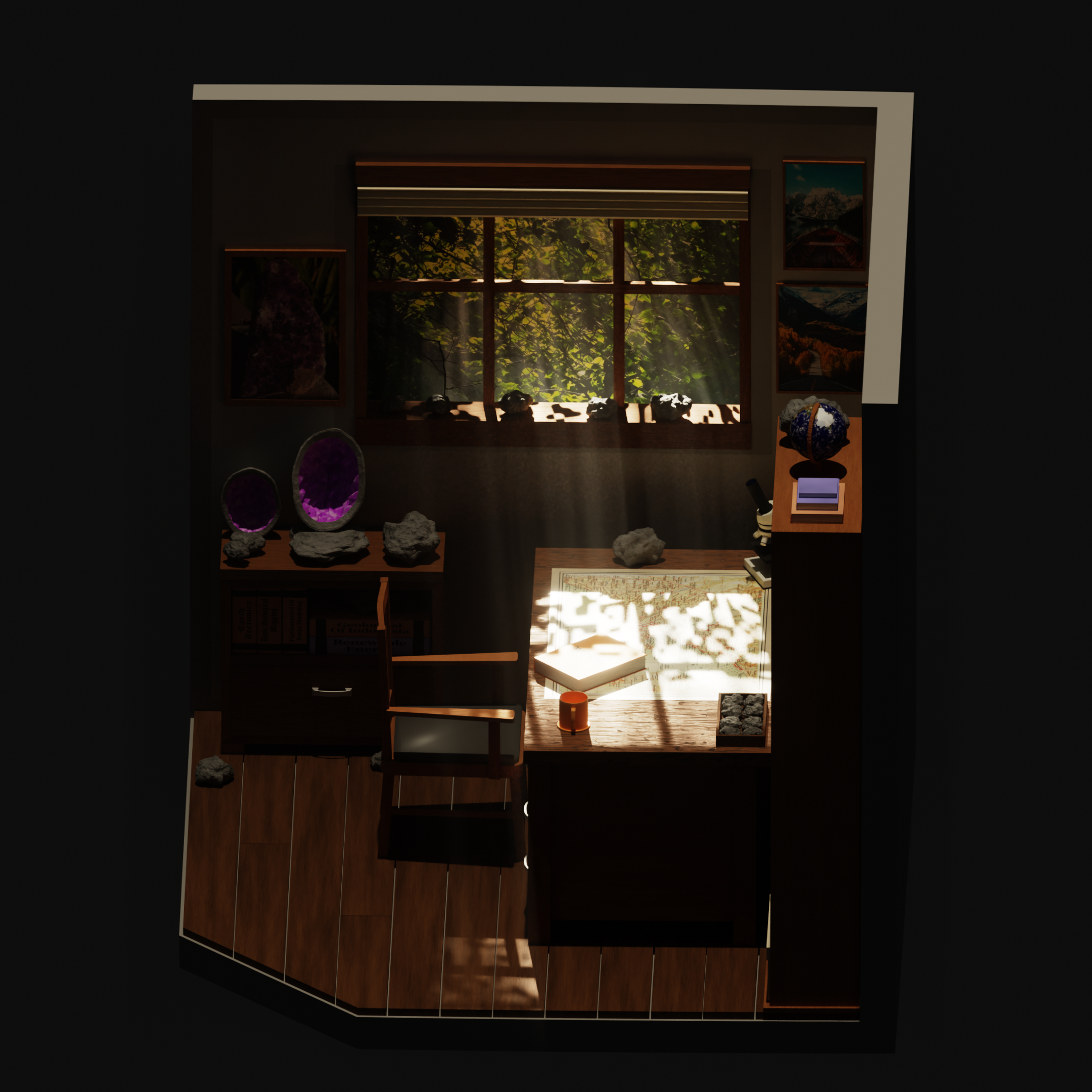
Interactive low-poly geological dioramas, procedural rock shaders, and volumetric renders with AR support.

Enter 3D Exhibition
Research & Notes

Geoscience Articles

Technical deep-dives on volcanic deformation, subsurface petrophysics, and spatial programming tutorials.

Read Publications
Flagship Engines

Featured Intelligence

Experience our heavy-duty browser geoprocessing workspaces in action.

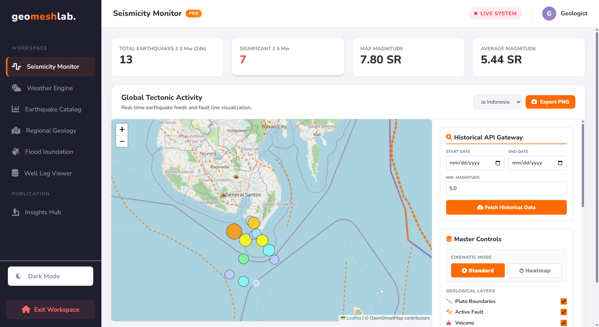
Seismicity Monitor Preview
Live USGS Feed

Seismicity Monitor & Fault Replay

Track global tectonic events in real time. Features an automated Mercalli (MMI) ground-shaking estimator, volcanic proximity alerts, and a chronological Time-Lapse Player to replay rupture sequences along active fault lines.

RESTful GeoJSON MMI Attenuation Volcanic Buffer
Launch Seismicity Engine →
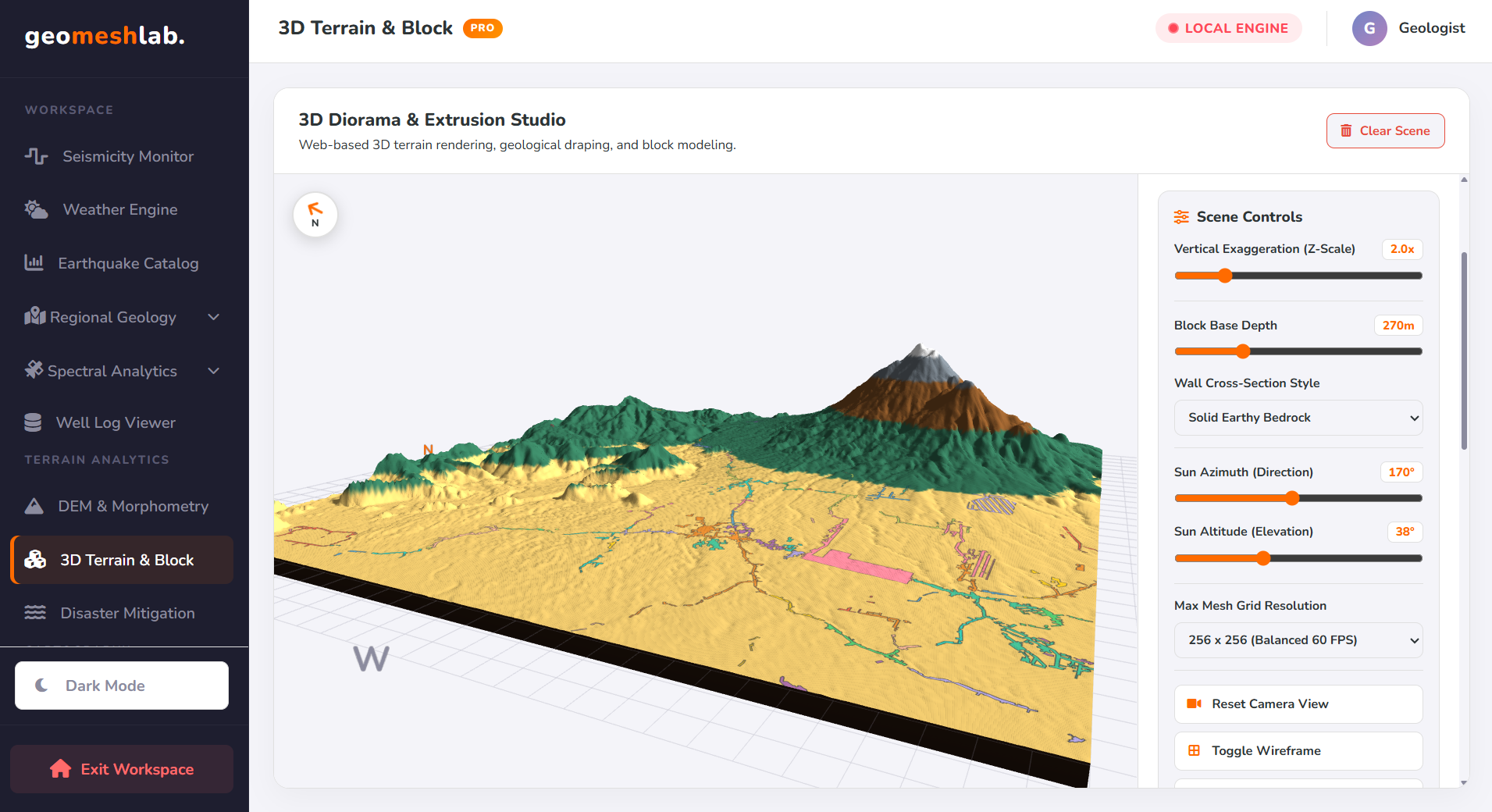
3D Diorama & Extrusion Studio
Three.js WebGL Engine

3D Diorama & Block Extrusion Studio

Transform flat Digital Elevation Models (.tif) into interactive 3D geological block diagrams. Customize vertical exaggeration, extrude stratified sedimentary crust walls, drape 2D geological maps over the relief, and export binary .GLB models directly to Blender.

WebGL Mesh Vector Draping Blender .GLB Export
Launch 3D Studio →
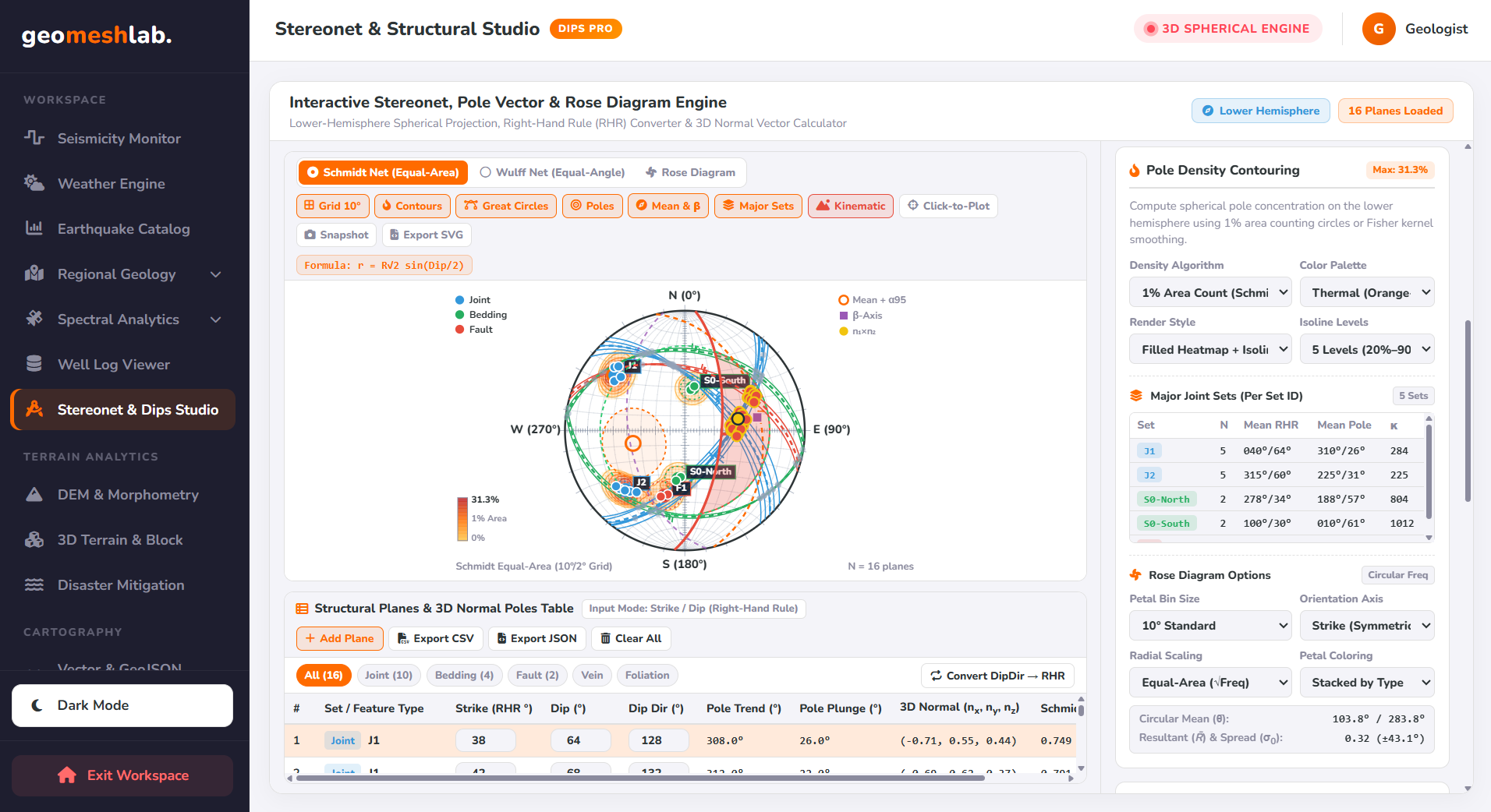
Stereonet & Structural Studio
Interactive Stereonet

Stereonet & Structural Studio

Interactive Wulff and Schmidt Stereonet, Rose Diagram, and Kinematic Slope Stability analyzer for structural geology.

Schmidt Stereonet Wulff Net Rose Diagram
Launch Stereonet Studio →
Quick-Launch Other Specialized Engines: View Full Catalog →
Cloud Scripting & Local Binary Tools

Geoscience Developer Suite

Accelerate your pre-processing workflow with ready-to-run Google Earth Engine scripts and zero-upload format converters.

sar_volcanic_timeseries_prep.js — GEE Vault
// 1. FILTER SENTINEL-1 SAR DESCENDING ORBIT STACK
var s1Stack = ee.ImageCollection('COPERNICUS/S1_GRD')
  .filter(ee.Filter.eq('instrumentMode', 'IW'))
  .filter(ee.Filter.listContains('transmitterReceiverPolarisation', 'VV'))
  .filter(ee.Filter.eq('orbitProperties_pass', 'DESCENDING'))
  .filterBounds(geometry)
  .filterDate('2024-01-01', '2024-12-31');

// 2. SPATIO-TEMPORAL SPECKLE FILTER & EXPORT
var filtered = s1Stack.map(function(img) {
  return img.focal_median(3, 'circle', 'pixels');
});
Blender 3D & Procedural Shaders

3D Geological Dioramas

Low-poly scientific models, subsurface structural cross-sections, and stylized environments.

Enter Full 3D Gallery →
Scientific Storytelling

Latest Geoscience Articles

Read our newest technical notes on volcano deformation, geophysics, and spatial data engineering.

View All Articles →
Core Competencies

Driven by Geoscience,
Powered by Code.

Geomeshlab is a digital facility dedicated to transforming complex earth data into accessible, interactive web experiences.

Geospatial & InSAR Analysis

Multi-temporal radar interferometry (SNAP, MintPy, ISCE), optical spectral modeling, and automated terrain morphometry using QGIS, ArcGIS, and Google Earth Engine.

3D Geological Visualization

Crafting low-poly geological dioramas, procedural shader node trees, and Three.js WebGL block models in Blender to bridge scientific rigor and visual storytelling.

Client-Side WebGIS Engineering

Building zero-server, memory-safe geospatial engines powered by Web Workers, Transferable ArrayBuffers, and WebAssembly for instantaneous browser execution.